| CPC G06T 7/579 (2017.01) [G06T 7/74 (2017.01); G06T 2207/10016 (2013.01)] | 21 Claims |
|
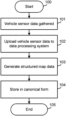
1. A method of generating structured map data, the method comprising:
receiving time-stamped sensor data from at least one sensor disposed on a vehicle;
receiving video data comprising a plurality of video streams provided by a respective plurality of cameras disposed on the vehicle, wherein the video data are time-stamped based on a timing signal provided by a global positioning system (GPS):
determining, based on the time-stamped sensor data, a plurality of spatial values each comprising a position of the vehicle and an associated time stamp, the plurality of spatial values including a particular spatial value indicating a particular position of the vehicle and a particular associated time stamp; and
adjusting the particular spatial value indicating the particular position of the vehicle based on two or more parallax differences in two or more respective relative positions of a fixed feature depicted in a plurality of image records captured in the video data.
|