| CPC G01V 3/165 (2013.01) [G01V 3/08 (2013.01); G01V 3/10 (2013.01); G01V 3/104 (2013.01); G01V 3/15 (2013.01); G01V 3/38 (2013.01); G01R 33/02 (2013.01); G01R 33/1215 (2013.01); G01R 33/1223 (2013.01)] | 17 Claims |
|
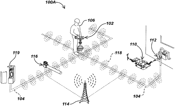
1. A method for uniquely identifying buried utilities in a multi-utility region, the method comprising:
receiving magnetic field signals at a dodecahedral antenna array of a magnetic field sensing utility locator while moving the magnetic field sensing utility locator over a region having a plurality of utilities buried therein, and providing output signals from the dodecahedral antenna array corresponding to the received magnetic field signals;
receiving the output signals from the dodecahedral antenna array in a processing element and processing the received output signals to identify utility data associated with the plurality of buried utilities, wherein the utility data comprises a plurality of location data points each indicative of location information pertaining to at least one of the buried utilities and one or more characteristics of the at least one of the buried utilities;
generating a plurality of clusters based on the identified location data points, wherein each of the plurality of clusters includes a set of location data points sharing common characteristics;
identifying one or more patterns exhibited by each of the plurality of clusters; and
classifying the plurality of clusters, based on the one or more patterns, to uniquely identify the buried utilities.
|