| CPC G01C 21/3461 (2013.01) | 20 Claims |
|
1. A system for determining and presenting visual representations, comprising:
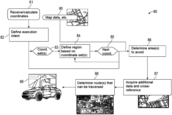
at least one processor including a receiving module configured to receive a set of coordinates representing one or more geographic locations of one or more features of interest;
the at least one processor including an analysis module configured to define a region corresponding to the set of coordinates, the region having an extent based on a level of uncertainty associated with the one or more features of interest, wherein the analysis module is configured to acquire a probability distribution describing a probability of the one or more features of interest occurring at a given location, the probability distribution defined relative to a coordinate; and
the at least one processor including a visualization module configured to generate a visual representation of the defined region and present the visual representation on a map, wherein the visual representation includes one or more visual features representing the probability distribution as a function of distance from the coordinate.
|