| CPC B64C 39/024 (2013.01) [G01C 21/3453 (2013.01); G05D 1/106 (2019.05); G06T 7/246 (2017.01); G06T 7/277 (2017.01); G06T 7/593 (2017.01); G06T 17/05 (2013.01); G06V 20/13 (2022.01); G06V 20/17 (2022.01); G08G 5/0069 (2013.01); G08G 5/045 (2013.01); B64U 2201/10 (2023.01); G06T 2207/10021 (2013.01); G06T 2207/10032 (2013.01); G06T 2207/20081 (2013.01); G06T 2207/20084 (2013.01); G06T 2207/30188 (2013.01); G06T 2207/30241 (2013.01); G06T 2207/30252 (2013.01)] | 20 Claims |
|
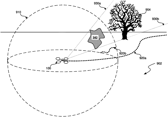
1. A method comprising:
generating a cost function map that associates a cost value with each of multiple regions of an image of a physical environment, wherein the cost value is indicative of a level of risk associated with navigating in an area of the physical environment corresponding to a particular region of the image; and
causing a vehicle to autonomously maneuver through the physical environment using the cost function map.
|